Earthquakes of the Indonesian Banda Arcs
Summary
Data last Updated: May 2009
The Banda Arcs area is renowned as one of high seismic and volcanic activity.
The root cause of this activity is the convergence of three major tectonic
plates: the Eurasian to the north and west, the Indian-Australian to the south
and the Pacific plate to the east (including the Caroline and Philippine Sea
plates). These large converging plates cannot all occupy the same area on the
surface of the earth and so, mountains are raised, plates subducted and many
smaller plates and terraines are shuffled around the margins of the large
plates.
One of the key geographical and geological features of the Banda Arcs is its
arcuate nature which is reflected deep within the earth by a subducting plate(s).
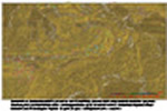
This is the primary feature depicted in the image and maps presented here. These are very simple words to describe a very complex situation.
USGS-NEIC Earthquakes
The USGS maintains a 1973-to-present, world-wide, earthquake data catalogue (PDE) at http://neic.usgs.gov/neis/epic/epic.html from where the data shown here have been extracted. These data are as downloaded
with no additional processing. Information on the limitations of the data is discussed here.
USGS - United States Geological Survey.
NEIC - National Earthquake Information Centre (US).
Many images and films produced by VisIt from the Lawrence Livermore National Laboratory.
These images should be opened in a new browser window or tab.
 |
May 09
10 meg Avi film |
Rotating hypocentres in 3D space. AVI, 10 megabyte film. Banda Area - all PDE earthquakes - depth colour coded. Rotation south to north, around latitude line. AVI should download and automatically run in media player. |
| |
May 09
10 meg Avi film |
Rotating hypocentres in 3D space. AVI, 10 megabyte film. Banda Area - all PDE earthquakes - depth colour coded. Rotation east to west, around longitude line. AVI should download and automatically run in media player. |
| |
May 09
2.2 meg Avi film |
Earthquakes per year in 3D space. AVI, 2.2 megabyte film. Banda Area - all PDE earthquakes - depth colour coded. Each year's activity is sequentially shown (the year is displayed in top-left grey box as part of file name) . AVI should download and automatically run in media player. |
 |
May 09
342Kb |
3D surface image of gridded hypocentres, viewed from the East. To grid earthquake depth data is rightly considered inappropriate but, this image clearly shows the shape of the Wadati-Benioff zone curving around the Banda Arc. The grid is NOT an accurate representation of the subducting plates(s), for example, it implies a single subducting plate that is continuous from the furthest west to Seram. This may, or may not, be correct. However, the surface does show gross features that are significant. |
| |
May 09
442Kb |
Banda Area - all hypocentres 0 to 675Km - depth colour
coded. |
 |
May 09
621Kb |
Banda Area - all quakes - magnitudes in two colours. |
 |
May 09
620Kb |
Banda Area - all quakes - magnitudes in colour range. |
Earthquake Focal Mechanisms
The USGS/NEIC maintains a 1976-to-present, world-wide, earthquake focal mechanism data catalogue at http://neictest.cr.usgs.gov/neis/sopar/ from where the data shown here have been extracted. The data displayed are the Harvard Centroid Moments with focal mechanism symbols (beach balls) created by GMT. There are usually too many to plot without over-printing, so the data are split into decades for display (1970s to 2000s).
A focal mechanism solution (also known as a fault plane solution) is a way of
showing the activated fault, and the direction of slip on it, from an earthquake using
circles with two intersecting curves that look like beach balls. There is a lot
of information about earthquakes at the USGS/NEIC website http://earthquake.usgs.gov/ and this page, also
from the USGS, is a good explanation of focal mechanisms.
USGS - United States Geological Survey
NEIC - National Earthquake Information Centre (US)
GMT - Generic Mapping Tools by Paul Wessel and Walter H.F. Smith and volunteers.
These images should be opened in a new browser window or tab.
 |
May 09
2000Kb |
Earthquake fault solutions from Harvard focal mechanisms. Strike, dip, sense (left or right lateral), normal or reverse and depth shown. |
 |
May 09
4700Kb |
Earthquake fault solutions from Harvard focal mechanisms. Strike, dip, sense (left or right lateral), normal or reverse and depth shown. Base image is of gravimetric lineaments overlying an image of the second derivative in the horizontal plane for combined surfaces of complete Regional Bouguer, Bouguer and Free-air(height correction) anomalies. |
 |
2100Kb |
1970s Banda Area Harvard focal mechanisms - all depths colour coded; magnitude shown by relative symbol size. Base image is of gravimetric lineaments overlying an image of the second derivative in the horizontal plane for combined surfaces of complete Regional Bouguer, Bouguer and Free-air(height correction) anomalies. |
 |
2100Kb |
1980s Banda Area Harvard focal mechanisms - all depths colour coded; magnitude shown by relative symbol size. Base image is of gravimetric lineaments overlying an image of the second derivative in the horizontal plane for combined surfaces of complete Regional Bouguer, Bouguer and Free-air(height correction) anomalies. |
 |
2100Kb |
1990s Banda Area Harvard focal mechanisms - all depths colour coded; magnitude shown by relative symbol size. Base image is of gravimetric lineaments overlying an image of the second derivative in the horizontal plane for combined surfaces of complete Regional Bouguer, Bouguer and Free-air(height correction) anomalies. |
 |
May 09
2100Kb |
2000-2005 Banda Area Harvard focal mechanisms - all depths colour coded; magnitude shown by relative symbol size. Base image is of gravimetric lineaments overlying an image of the second derivative in the horizontal plane for combined surfaces of complete Regional Bouguer, Bouguer and Free-air(height correction) anomalies. |
 |
May 09
2100Kb |
2005-2009 Banda Area Harvard focal mechanisms - all depths colour coded; magnitude shown by relative symbol size. Base image is of gravimetric lineaments overlying an image of the second derivative in the horizontal plane for combined surfaces of complete Regional Bouguer, Bouguer and Free-air(height correction) anomalies. |
© Steve Kaye. Protected under UK and international law. May be used free of charge. Selling without prior written consent prohibited. Obtain permission before redistributing. In all cases this notice must remain intact.


