Eastern Indonesia complete Bouguer gravity residual anomaly maps
Summary
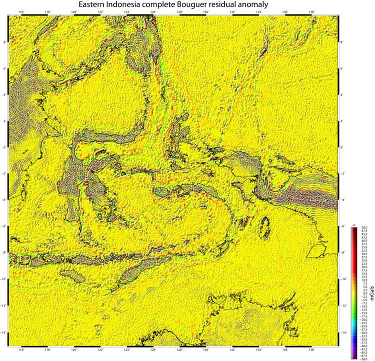
The maps available from the images below are of the complete Bouguer residual anomaly surface. The regional surface was produced by applying a gaussian, low-pass, 21x21 arc minute filter to the Bouguer anomaly surface of the whole area. The residual was produced by subtracting the regional surface from the Bouguer anomaly surface.
Details of the data used are available on the Data Sources page.
Details of the reduction process are available on the Data Processing page.
Note: the marine topographic data, used to produce the Bouguer anomaly, have not had the ship track artifacts removed which can lead to the creation of odd features in the Bouguer residual anomaly maps - check the topography maps if in doubt.
Interactive maps - complete Bouguer residual anomaly
The map below has been sectioned into 25 clickable regions. Clicking on a particular region will open a new tab showing the zoomed in region in more detail. To see the whole image in a new tab click here.
Timor Island

© Steve Kaye. Protected under UK and international law. May be used free of charge. Selling without prior written consent prohibited. Obtain permission before redistributing. In all cases this notice must remain intact.
