Click the image below to open a larger version (3.7mb) in a new tab.

Gravity data can be examined in many different ways: on this page, these most areally extensive of geophysical data, are subjected to an experiment in principal component analysis (PCA) followed by unsupervised classification (cluster analysis). This results in images that assist in determining the possible crustal types for the region.
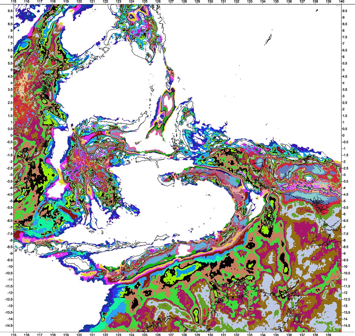
Bouguer anomaly surfaces, computed using different crustal reduction densities, were subjected to PCA examination. The resulting components 1 and 2 were then passed to an unsupervised classification routine. This resulted in an image of 100 classes (a number selected for computational efficiency, ease of examination and uncluttered images suitable for web display).
The image was examined and a range of classes selected to represent a particular crustal type, e.g. Indian oceanic crust.
The method produces a coloured grid of classes that represent the Bouguer anomaly signature of the crust. The following images are experimental but do appear to impart additional knowledge about the type of crust in a particular area. This attribute is useful in a region so poorly understood. However, like most methods that examine gravity data, the classes do not necessarily represent a definitive geological unit - these images are not geological maps.
Not only can the classes be examined in absolute terms across the whole area but also relatively in smaller areas, i.e. the differences in classes seen in one area might allow the differentiation of local crustal units.
Warnings:
1) as previously mentioned, the choice of 100 classes was pragmatic. Other class ranges were examined - from 40 to 200 - but these impart too little information (40) or too much (200).
2) The Bouguer anomaly images of PCA and classification includes information of the topography, hence the on-shore areas have a shorter wavelength/higher frequency signature compared to off-shore areas, consequently the number of on-shore classes may unrealistically exceed the off-shore.
4) The grouping of classes into type areas, for example 'Scott Plateau - Australian volcanic/thinned continental margin', is subjective and prone to error, i.e. the type area chosen may not be justified or misleading or, more likely, classes chosen at the margins of an area might be wrong.
5) Care should be taken when comparing similar colours. Users are advised to make use of the colour legend, opened in a new window, to see the adjacent colour classes for an area type.
6) PCA component 3 has not been used because it contains too much noise and information resulting from the author's work to merge data for the island groups of Timor, Tanimbar and Kai with those derived from satellites. The latter effect can also be detected in components 1 and 2 and is therefore contained within some images below. This partially explains why the Kai Besar area is shown as volcanic crust when it is known to consist of Cenozoic and Mesozoic Australian affinity units.
7) Finally, this work is experimental. The ambiguity of the gravity method is not removed. In some areas the designated crustal type is known to be wrong but the coloured classes still allow a relative examination of adjacent grid nodes which is useful when other information is available, e.g. seismic, geological mapping etc..
Details of the data used are available on the Data Sources page.
Details of the reduction process are available on the Data Processing page.
Please read the caveats at the bottom of this page.
Click the image below to open a larger version (3.7mb) in a new tab.
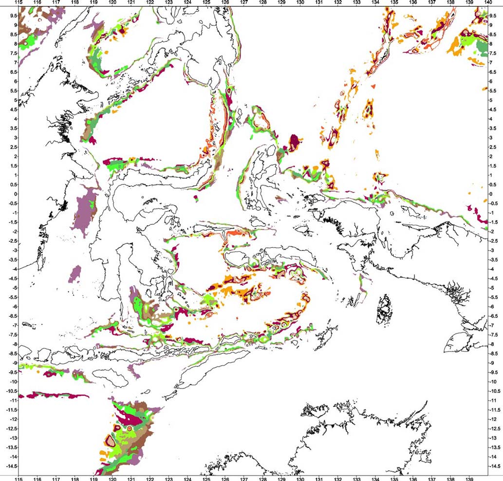
The following images show how the oceanic areas in and around Eastern Indonesia can be visualised in Bouguer anomalies. Not only are individual oceanic plates identified but also quite subtle variations within plates. Viewers should probably ignore wisps of colour distributed outside of blocks of coloured classes. The author has resisted the temptation to write reams of text about the images, especially those features that might be considered unusual.
The names associated with the images, for example 'Indian Ocean oceanic crust', refer to the area used to select the classes for the type and what the crust might be made of.
Clicking on the images will open a larger version in a new tab. Use this legend, in a new window, while viewing images.
 Indian Ocean and Philippine Sea oceanic plates
 Caroline oceanic plate
 Ayu Trough area - divergent boundary
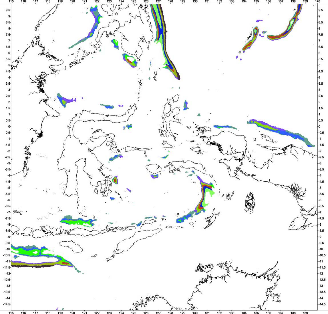 Oceanic plate subduction zones and thrusts
 Weber Deep
 Combined oceanic classification types
The names associated with the images, for example 'Australian Precambrian and Palaeozoic cratonic areas', refer to the area used to select the classes for the type and what the crust might be made of.
Clicking on the images will open a larger version in a new tab. Use this legend, in a new window, while viewing images.
 Australian Precambrian and Palaeozoic cratonic areas
 Australian Mesozoic shelf and basin areas
 Australian Mesozoic/Cenozoic continental margin
 Timor-Tanimbar-Seram Trough(s) foredeep and imbricates
 New Guinea continental collision zone (undifferentiated)
 Classification of Cenozoic sedimentary depocentres
 Combined continental classification types
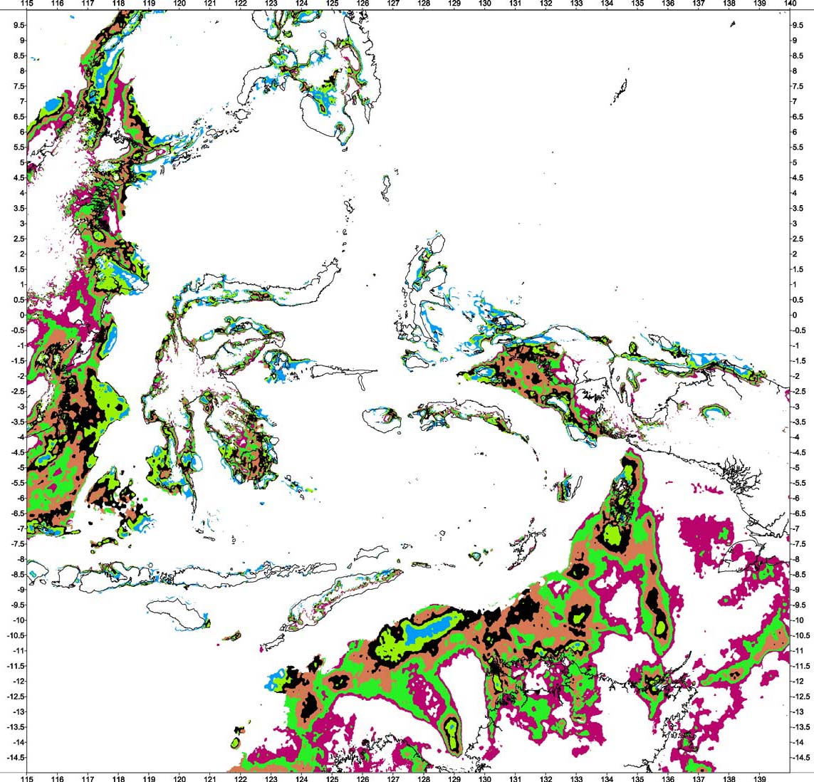
The names associated with the images, for example 'Molucca Sea oceanic basin', refer to the area used to select the classes for the type and what the crust might be made of.
Clicking on the images will open a larger version in a new tab. Use this legend, in a new window, while viewing images.
 Classification of volcanic arcs - Sunda, Banda, Sulu, Halmahera and Sangihe. Note that the island of Kai Besar is mistakenly calculated as volcanic.
 Classification of the Savu Basin
 Classification of the Molucca Sea oceanic basin
 Classification of Scott Plateau - Australian volcanic/thinned continental margin
 Combined crustal types existing between oceanic and continental crustal areas
Caveats:
The usual warnings of non-uniqueness of the gravity method apply.
The method was applied to grids of 0.01667 arc degrees (1 minute of arc). Images on this site are degraded from the originals.
Some geophysicists think it inappropriate to replace sea-water with rock, i.e. applying a Bouguer correction to marine areas. They may also think that to then combine multiple Bouguer surfaces is even worse. This author takes a pragmatic view - if the results are beneficial and allow a greater understanding of this under-resolved region, so much the better.
Satellite derived gravity measurements are unreliable in water depths shallower than 200-300 metres and for bathymetric features with a wavelength shorter than approximately 15Kms. These limitations essentially produce an unknown and immeasurable level of noise on top of longer wavelength bathymetric features. These factors affect much of the Arafura Sea and the area between Australia and Indonesia.
Bathymetric shiptrack data have not been removed from the satellite topography grids used to produce the complete Bouguer correction. Consequently some class boundaries may be caused by these data.